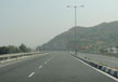
Roads In Gujarat
Gujarat is a haven of a mammoth transportation network encompassing national highways, state highways, district highways, district roads and rural roads (sugarcane roads and Panchayat roads). The State consists of more than 300 state highways covering a distance of 19,761 Km and 13 national highways covering a distance of 3245 Km.
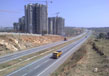
One of the most widespread and all embracing as well as traffic exhaustive road-networks in India is found in the state of Gujarat. The present total road length in Gujarat is approximately 74,500 Km and can roughly be divided into a core and a non-core network. National highways and about 6000 Km state highways comprise the core network whereas the remainder comprises the non-core state highways, major district roads, other district roads and village roads.
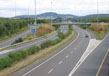
If one takes a look at the road density in the state of Gujarat one finds the same to be more or less 38 Km per 100 Sq. Km and 146 Km per lakh of population and these figures are largely comparable to the road density for India being 43 Km per 100 Sq. Km and 126 Km per lakh of population. In order to attend to the need of improvement and preservation of the core network the state government has started a go-getting and ambitious 6000 Km State Highway Development Program (SHDP). In order to supplement and enhance road connectivity of DFC and DMIC areas with Ports and other growth centers arterial network has been identified and recognized.
The Golden Quadrilateral North South East West axis of the National Highway Development Program passing through to the State have given benefit and advantage to the national highway network of Gujarat. That apart, what has resulted in a reasonably better quality national highway network in the State compared to a number of other parts of the country is the combined effect of the revolutionary PPP Roads, expressways, 6 lane projects (under advanced phases of NHDP), sensible and discreet use of external funding and a comparatively better maintenance regime. A number of network improvement schemes and projects such as the World Bank Funded Roads, Pragati Path, Kisan Path and Vikas Path road development programs have been employed and put into operation by the State and such programs have culminated in a sizeable advancement and improvement of quite a few key stretches of State highways thereby offering reasonably sound experiences of ridership.
To provide and accommodate the requirements of up-and-coming growth centers in vein of industrial parks, ports, SEZs and SIRs, and urban centers which will identify and describe the Gujarat economic landscape is a key challenge for the core network. It is needless to say that moving onwards and continuing to make available quality roads of sufficient capacity will be significant and vital for the state. It is important to see this in the background of facilitating transaction and competitiveness. Providing a class and an excellent road network through output focused delivery systems can ensure this.
The first state in India to have a law governing Build Own and Transfer (BOT) transaction and such other measures and arrangement coupled with private participation in infrastructure is Gujarat. It is interesting indeed that the roads in the transport sector in Gujarat account for almost 17.05 % of the total planned investments amounting to Rs. 39110 crores for the period upto 2020 of “ Blue Print for Infrastructure in Gujarat-Vision 2020” prepared by GIDB.
Category of Roads in Gujarat
The roads in Gujarat and their extent/distance may be categorized as below:
| Type of Road | Length (in km) |
| State Highways: | 19,761 |
| National Highways: | 3,245 |
| Sugarcane Roads: | 1,746 |
| Panchayat Roads: | 30,019 |
List of State Highways in Gujarat
| GJ SH No | Route | Total length | District |
| GJ SH 1 | Bagodara - Dhandhuka - Ranpur -Jasdan - Gondal | 186.67 km | Bhavnagar, Ahmedabad, Rajkot |
| GJ SH 2 | Ahmedabad - Kathalal - Lasundra-Balasinor - Lunawada - Santrampur -Zalod | 116.52 km | Kheda, Ahmedabad, Dahod, Panchmahal, |
| GJ SH 2A | Santrampur - Kadana - Dungarpur Road | 35.17 km | Panchmahal |
| GJ SH 3 | Ahmedabad - Mehmdavad - Nadiad | 32.40 km | Kheda, Ahmedabad |
| GJ SH 4 | Ahmedabad - Sarkhej - Dholka - Simaj -Vataman | 45.80 km | Ahmedabad |
| GJ SH 5 | Umargam - Vapi - Dharampur - Vansda - Valod (Buhari) - Netrang - Rajpipla -Bodeli - Halol - Godhra - Lunawada -Malpur - Modasa - Shamlaji | 332.20 km | Navsari, Valsad, Narmada, Tapi, Vadodara, Bharuch, Sabarkantha, Panchmahal |
| GJ SH 5A | Pavagadh Hill Road | 5.20 km | Panchmahal |
| GJ SH 5B | Godhra Link Road | 7.31 km | Panchmahal |
| GJ SH 6 | Lakhpat - Koteshwar - Narayan Sarovar -Kothara - Mandvi - Gandhidham -Jodia - Jamnagar - Khambhalia-Dwarka - Una -Mahuva - National Highway 8E - Bhavnagar - Khambhat -Amod - Dahej - Bharuch - Ankleshwar -Hasot - Olpad - Surat - Valsad - Tithal | 1214.32 km | Jamnagar, Kutchh, Bhavnagar, Porbandar, Vadodara, Anand, Surat, Bharuch, Valsad |
| GJ SH 7 | Maliya - Halvad - Dhrangadhra -Viramgam - Sitapur - Becharaji -Chanasma - Patan | 43.60 km | Surendranagar, Kutchh, Patan, Ahmedabad |
| GJ SH 8 | Bagodra - Vataman - Tarapur - Dharmaj -Borsad - Vasad | 101.76 km | Anand, Ahmedabad |
| GJ SH 9 | Waghai-Saputara | 52.00 km | Dang |
| GJ SH 10 | Harij - Patan - Siddhpur - Kheralu - Sipor - Valasana - Idar - Dholvani - Vijaynagar till the border of Rajasthan | 112.32 km | Mahesana, Patan, Sabarkantha |
| GJ SH 11 | Borsad - Umeta - Singhrot - Gotri -Vadodara - Dabhoi - Bodeli - Chhota Udaipur till the boundary of the state to Alirajpur in Madhya Pradesh | 148.20 km | Vadodara, Anand |
| GJ SH 12 | Nadiad - Lingada - Umreth - Dakor -Thasara - Godhra - Kathwada up to the boundary of the state to Jhabua in Madhya Pradesh | 58.75 km | Anand, Kheda, Panchmahal, Vadodara, Dahod |
| GJ SH 13 | Ankleshwar - Valia - Netrang - Dediapada - Sagbara till the boundary of the state to Akkalkuva, Maharashtra | 108.40 km | Narmada, Bharuch |
| GJ SH 14 | Waghai - Ahwa - Chinchali - Babulghat | 70.40 km | Dang |
| GJ SH 15 | Bilimora - Chikhli - Vansda - Waghai | 55.00 km | Dang, Navsari |
| GJ SH 16 | Bagodara - Dholka - Rasikpura - Khambhat | 108.20 km | Kheda, Ahmedabad, Anand |
| GJ SH 17 | Ahmedabad - Sarkhej - Sanand - Charodi (TATA Nano Factory) - Viramgam - Wadhwan - Muli - Chotila | 58.60 km | Surendranagar, Ahmedabad, Rajkot |
| GJ SH 18 | Viramgam - Mandal - Dasada - Panchasar - Sami - Harij - Radhanpur | 79.40 km | Patan, Ahmedabad |
| GJ SH 19 | Surendranagar - Patdi - Dasada - Becharaji - Mehsana | 106.00 km | Mehsana, Surendranagar |
| GJ SH 20 | Dhrangadhra - Dudhrej - Surendranagar -Limbdi - Dhandhuka | 99.60 km | Ahmedabad, Surendranagar |
| GJ SH 21 | Halvad - Sara - Muli - Sayala - Sudamada -Paliyad - Botad - Gadhada - Dhasa -Damnagar - Paravadi - Gariadhar - Jesar -Asarana - Dungar - Victor - Port Chanch | 169.70 km | Bhavnagar, Surendranagar, Amreli |
| GJ SH 22 | Halvad - Morvi - Tankara - Latipur - Dhrol - Jambuda | 105.10 km | Rajkot, Surendranagar, Jamnagar |
| GJ SH 23 | Rajkot - Kalawad - Khatiya - Lalpur -Khambhalia | 73.10 km | Jamnagar, Rajkot |
| GJ SH 24 | Rajkot - Morvi - Navalakhi | 125.32 km | Jamnagar, Rajkot |
| GJ SH 25 | Bhavnagar - Shihor - Bobra - Rajkot | 160.62 km | Amreli, Bhavnagar, Rajkot |
| GJ SH 26 | Bedeshwar - Jamnagar - Kalawad -Jamkandorana - Dhoraji - Junagadh -Mendarada - Sasan - Talala - Veraval | 121.40 km | Jamnagar, Rajkot, Junagadh |
| GJ SH 27 | Jamnagar - Lalpur - Ranavav - National Highway 8B - Bhanvad | 108.90 km | Porbandar, Jamnagar |
| GJ SH 28 | Khambhalia - Advana - Porbandar | 62.70 km | Porbandar, Jamnagar |
| GJ SH 29 | Limbdi - Vankvaya - Bhatiya - Kuranga | 22.00 km | Jamnagar, Surendranagar |
| GJ SH 30 | Junagadh - Khadia - Bilkha - Bagasara -Amreli | 76.30 km | Amreli, Junagadh |
| GJ SH 31 | Chorvad - Holiday Camp - Gadu - Keshod - Vanthali - Junagadh - Jetpur - Devda -Vasavad - Babra - Bhadeli - Gadhada -Umrali - Songadh - Palitana - Talaja | 298.35 km | Junagadh, Rajkot, Bhavnagar, Amreli |
| GJ SH 31A | Porbandar - Rajkot - Bamanbore Road going across Jetpur city boundary | 8.05 km | Porbandar, Rajkot |
| GJ SH 41 | Ahmedabad - Mahesana - Unjha - Palanpur | 131.33 km | Mahesana, Ahmedabad, Banaskantha, Patan |
| GJ SH 59 | Nadiad - Mahudha - Kathalal - Kapadwanj - Bayad - Dhansura -Modasa - Raighad | 127.20 km | Sabarkantha, Kheda |
| GJ SH 60 | Kheda - Mahmdavad - Mahudha - Alina - Dakor - Umreth - Bhalej - Anand -Vadtal | 90.59 km | Anand, Kheda |
| GJ SH 80 | Ahwa - Navapur till the boundary of the state in Maharashtra | 37.40 km | Dang |
| GJ SH 83 | Umreth - Ode - Sarsa - Anand -Karamsad - Sojitra - Tarapur - Kanawada | 70.60 km | Ahmedabad, Anand |
| GJ SH 140 | Bareja - Navagam - Vasna - Bujarg -Matar - Limbdi - Sojitra - Piplav - Petlad - Borsad | 75.03 km | Kheda, Ahmedabad, Anand |
| GJ SH 143 | Majara - Talod - Harsol - Ranasan -Gambhaoi - Bamna - Vankaner | 84.30 km | Sabarkantha |
| GJ SH 145 | Himatnagar - Dhansura - Malpur -Meghraj - Titoi - Shamlaji - Bhiloda - Idar | 152.77 km | Sabarkantha |
| GJ SH 160 | Padra - Sadhli - Karjan - Vemar - Sinor-Poicha - Rajpipla - Dediapada Road Bridge and accesses | 0084.85 km | Narmada, Vadodara |
Other State Highways in Gujarat
GJ SH 32, GJ SH 33, GJ SH 34, GJ SH 35, GJ SH 36, GJ SH 37, GJ SH 38, GJ SH 39, GJ SH 40, GJ SH 42, GJ SH 43, GJ SH 44, GJ SH 45, GJ SH 46, GJ SH 47, GJ SH 48, GJ SH 49, GJ SH 50, GJ SH 51, GJ SH 52, GJ SH 53, GJ SH 54, GJ SH 55, GJ SH 56, GJ SH 57, GJ SH 58, GJ SH 61, GJ SH 62, GJ SH 63, GJ SH 64, GJ SH 65, GJ SH 66, GJ SH 67, GJ SH 68, GJ SH 69, GJ SH 70, GJ SH 71, GJ SH 72, GJ SH 73, GJ SH 74, GJ SH 75, GJ SH 76, GJ SH 77, GJ SH 78, GJ SH 79, GJ SH 81, GJ SH 82, GJ SH 84, GJ SH 85, GJ SH 86, GJ SH 87, GJ SH 88, GJ SH 89, GJ SH 90, GJ SH 91, GJ SH 92, GJ SH 93, GJ SH 94, GJ SH 95, GJ SH 96, GJ SH 97, GJ SH 98, GJ SH 99, GJ SH 100, GJ SH 101, GJ SH 102, GJ SH 103, GJ SH 104, GJ SH 105, GJ SH 141, GJ SH 142, and GJ SH 144.
List of National Highways in Gujarat
| S.No. | NH No. | Route | Length (km.) |
| 1 | NE-1 | Ahmedabad - Vadodara Expressway | 93 km (58 mi) |
| 2 | 6 | Hajira - Surat - Bardoli - Vyara - Songadh up to Maharashtra Border | 177 km (110 mi) |
| 3 | 8 | From Rajasthan Border - Himatnagar - Ahmadabad - Anand - Vadodara - KarjanBharuch - Ankleshwar - Chalthan (Surat) - Navsari - Valsad - Vapi - Maharashtra Border | 498 km (309 mi) |
| 4 | 8A | Ahmedabad - Bagodra - Limbdi - Bamanbore - Morbi - Samakhiali - Kandla – Mandvi - Vikhadi - Kothara -Naliya up to Narayan Sarovar | 618 km (384 mi) |
| 5 | 8B | Bamanbore - Rajkot - Gondal - Jetpur - Dhoraji - Kutiyana - Porbandar | 206 km (128 mi) |
| 6 | 8C | Chiloda - Gandhinagar - Sarkhej | 46 km (29 mi) |
| 7 | 8D | Jetpur - Junagadh - Maliya - Somnath | 127 km (79 mi) |
| 8 | 8E | Dwarka - Porbandar - Navibabder - Somnath - Kodinar - Una - Mahuva - Talaja - Bhavnagar | 445 km (277 mi) |
| 9 | 14 | From Rajasthan Border - Palanpur - Deesa - Sihori - Radhanpur | 140 km (87 mi) |
| 10 | 15 | Samakhiali - Santalpur - Radhanpur - Bhaghar - Tharad up to Rajasthan Border | 270 km (170 mi) |
| 11 | 59 | Ahmedabad - Kathua - Godhra - Dahod up to M.P. Border | 211 km (131 mi) |
| 12 | 113 | Dahod - Limdi - Zalod - Rajasthan Border. | 40 km (25 mi) |
| 13 | 228 | Dandi heritage route Sabarmati Ashram - Aslali - Navagam - Matar - - Anand - Borsad - Kankapura - Kareli -Ankhi - Amod - Derol - Ankleshwar - Mangrol - Umrachi - Bhatgam - Delad - Surat - Vanjh - Navsari - Kardi -Dandi | 374 km (232 mi) |
Bridges in Gujarat
Ellis Bridge
In Ahmedabad, Gujarat, across the Sabarmati River is situated a century old heritage bridge called the Ellis Bridge. Constructed in 1892, this bowstring arch truss bridge was the first bridge of Ahmedabad. Later on new concrete wings were constructed on either side of the said bridge in the year 1997and it was renamed as Swami Vivekananda Bridge. However people still know it by its old name.
An iconic landmark and symbol of Ahmedabad, this 120 year old bridge appeared in films like Kai Poche! which was released in 2013 and Kevi Rite Jaish released in 2012. Most remarkably at the west end of the bridge is located the Karnavati Art Gallery which regularly exhibits art.
Golden Bridge
In the year 1881, the British, in order to cater to their need of a bridge across Narmada River for the purpose of creation of superior access to trade and official administration officials in Bombay(now known as Mumbai), built the Golden Bridge that connects Ankleshwar to Bharuch.
Actually this bridge is called the Narmada Bridge.
It is fascinating that the golden Bridge, though having confronted with and exposed to a number of floods and natural disasters like earthquakes has not only survived them all but has stood tall for 129 years providing and facilitating daily transportation to the people of Ankleshwar and Bharuch.
As a matter of fact, this bridge, which is as much a part of the rich history of Bharuch as are the city’s archaeological and architectural wonders, mostly temples, is undeniably worth a look.
Nehru Bridge
Playing the role of an artery of major public transport for the city of Ahmedabad in the State of Gujarat is a major bridge running over the river Sabarmati and known as the Nehru Bridge. As compared to the landmark Ellis Bridge the Nehru Bridge is a modern, superior and larger one being dedicated to the first prime minister of india Jawahar Lal Nehru.
The Patang Revolving Restaurant, which is one of the attractions of Ahmedabad city, is positioned near the Nehru Bridge on the banks of Sabarmati River.
Subhash Bridge
On account of its association with Mahatma Gandhi, Subhash Bridge is an important area in Ahmedabad. 1.5 Km away from Subhash Bridge is located the Gandhi Ashram. It is notable that the Gandhi Ashram Shopping Area is a store house of Khadi. With more than 80 residential societies spread over Subhash Bridge stands as the residential area of Ahmedanbad, and has been separated from the rest of the city by a railway line in the west and the Sabarmati River to its eastern side.
Related Image

Also Browse Following Under This Section
Related Topics
Roads In Gujarat
Gujarat is a haven of a mammoth transportation network encompassing national highways, state highways, district highways....
Cities and Destinations
Gujarat is the 7th largest state and is located in the western part of India. It is one of the most popular tourist....
Gujarat - "The Land of the Legends"
Discover the knowledge of brilliance in...